• GEO-LEO
    • Deutsch
    • English
  • GEO-LEO
  • English 
    • Deutsch
    • English
  • Login
View Item 
  •   Home
  • Alle Publikationen
  • Institutionelle Serien und Zeitschriften
  • Geologische Karte 1 : 25 000 (GK25)
  • View Item
  •   Home
  • Alle Publikationen
  • Institutionelle Serien und Zeitschriften
  • Geologische Karte 1 : 25 000 (GK25)
  • View Item
JavaScript is disabled for your browser. Some features of this site may not work without it.

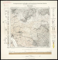
[Neue Nr. 2610] Neermoor [Moormerland] / Geologische Karte

Geologische Karte 1:25000

Wildvang, Dodo
1928
Kraatz, Berlin
Map, digitized
Koordinaten: E 007 20 - E 007 30 / N 053 24 - N 053 18
Deutsch
Sponsor: DFG, SUB Göttingen
DOI: https://doi.org/10.23689/fidgeo-2227
Wildvang, Dodo, 1928: "Geologische Spezialkarte von Preussen und den Thüringischen Staaten" und Nachfolgewerke; [Neue Nr. 2610]; Neermoor [Moormerland]; Gradabteilung 22, Blatt 37. Kraatz, Berlin, DOI 10.23689/fidgeo-2227.
 
Zur Übersichtskarte
 
Thumbnail
View/Open
Geologische Karte (pdf) (11.85Mb)
Geologische Karte (jpg) (82.91Mb)
Georeferenzierter Blattspiegel (GeoTIFF) (109.4Mb)
Metadata Export:
Endnote
BibTex
RIS
  • Abstract
Geologische Karte 1: 25 000. Digitalisat des FID GEO (Fachinformationsdienst Geowissenschaften der festen Erde), erstellt durch das GDZ (Göttinger Digitalisierungszentrum), Karte aus dem Bestand der SUB Göttingen. GeoTIFF erstellt durch FID GEO, SUB Göttingen.
Statistik:
View Statistics
Collection
  • Geologische Karte 1 : 25 000 (GK25) [459]
Subjects:
GeoTIFF
Geologische Karte
Neermoor
Moormerland
Public Domain Mark 1.0CC Public Domain Mark 1.0

ImpressumPrivacyAbout usTerms of UseContact UsSend Feedback
DFGSUBFID GEOFID Montan


Submit here
Help

All of Geo-Leo e-docsCommunities & CollectionsBy Issue DateAuthorsSubjectsPeriodicalsTitlesThis CollectionBy Issue DateAuthorsSubjectsPeriodicalsTitles

Statistics

View Usage Statistics

ImpressumPrivacyAbout usTerms of UseContact UsSend Feedback
DFGSUBFID GEOFID Montan