Suche
Anzeige der Dokumente 81-90 von 6988
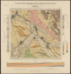
[Neue Nr. 4133] Wegeleben / Geologische Karte
(Berliner Lithogr. Inst., Berlin, 1926)
Geologische Karte 1: 25 000 mit Erläuterungen. Digitalisat des FID GEO (Fachinformationsdienst Geowissenschaften der festen Erde), erstellt durch das GDZ (Göttinger Digitalisierungszentrum), Karte aus dem Bestand der SUB ...
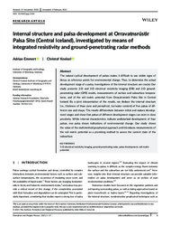
Internal structure and palsa development at Orravatnsrústir Palsa Site (Central Iceland), investigated by means of integrated resistivity and ground‐penetrating radar methods
 ; (
; (
The natural cyclical development of palsas makes it difficult to use visible signs of decay as reference points for environmental change. Thus, to determine the actual development stage of a palsa, investigations of the ...
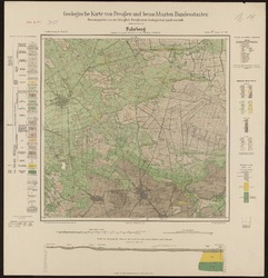
[Neue Nr. 3425] Fuhrberg [Wettmar] / Geologische Karte
(Kraatz, Berlin, 1915)
Geologische Karte 1: 25 000 mit Erläuterungen. Digitalisat des FID GEO (Fachinformationsdienst Geowissenschaften der festen Erde), erstellt durch das GDZ (Göttinger Digitalisierungszentrum), Karte aus dem Bestand der SUB ...
FS ALKOR Fahrtbericht/Cruise Report AL 275
(
Bw horizon in Holocene slope deposits (Kratzeburg, NE Germany) – dating and pedological characteristics
(
- E&G – Quaternary Science Journal
, 2015-12-11)
A soil-sediment sequence in NE Germany has provided information about the duration and intensity of formation of a Bw horizon in Holocene slope deposits. With a combination of optically stimulated luminescence (OSL), 14C- ...
Elemental iron (Fe0) for better drinking water in rural areas of developing countries
; Woafo, P. (
Many of the reasons behind the anthropogenic contamination problems in rural environments of developing countries lie in changes in the traditional way of life and the ignorance on the toxic potential of introduced ...
The aeolian sedimentary system along the transition between the Qilian Shan and northern Chinese drylands during the late Quaternary
(
- E&G – Quaternary Science Journal
, 2016-07-16)
THESIS ABSTRACT
Arctic ocean–sea ice reanalysis for the period 2007–2016 using the adjoint method
; ; ; ; (
We present an Arctic ocean–sea ice reanalysis covering the period 2007–2016 based on the adjoint approach of the Estimating the Circulation and Climate of the Ocean (ECCO) consortium. The spatiotemporal variation of Arctic ...
Anpassung von WaSiM-ETH und die Erstellung und Berechnung von Landnutzungs- und Klimaszenarien für die Niederschlag-Abfluss-Modellierung am Beispiel des Osterzgebirges
(Univ. Freiberg (Sachsen), 2006)
Für das Verbundprojekt EMTAL (Einzugsgebietsmanagement von Talsperren in Mittelgebirgslandschaften) wurden Methoden zur Klärung hydrologischer Fragen entwickelt. Das dafür gewählte Modell WaSiM-ETH kann den Abfluss im ...
Entwicklung mineralogischer Färbetechniken und ihre Anwendung auf spezifische Betonphasen zur Analyse der Zusammensetzung von zementgebundenen Baustoffen
(Univ. Halle (Saale), 2007)
Ziel der Arbeit war die Entwicklung neuer Methoden zur Analyse der Rezeptur, des Gefüges und der Alterung von zementgebundenen Baustoffen. Dazu wurden mineralogische Färbemethoden so weiterentwickelt, dass sie auf Betonproben ...
